This page is constantly evolving as a resource for conducting aerial surveys. At this point, it’s not meant to be comprehensive or provide everything you need to get started. It’s just to give you a general framework for the process and to point you to other resources. If you have questions or suggestions, please comment below.
The blog post describing BRIT’s initial aerial surveys is at https://fwbg.org/phytophilia/aerial-surveys-at-BRIT and provides a bit more background about some of the reasons BRIT is conducting these surveys.
Starting a new aerial survey project generally involves the following steps:
- Purchase/gather/make survey kit
- Perform survey
- Process images
Survey Kit
One of the best places to get started is at Public Lab (http://publiclab.org). This group provides a wealth of guides and tutorials about kite and balloon surveys as well as starter kits that include all you need except cameras and helium. Public Lab has a number of kits and individual items available at http://store.publiclab.org/collections/mapping.
For aerial kite surveys you will need at a minimum:
- Kite
- String
- String reel (a basic one comes with the Public Lab string, but we recommend one with handles such as this one).
- Camera – see details below
- Camera rig – The Public Lab kit comes with some parts that helps you build a rig with a soda bottle, but at BRIT we created some simple rigs out of aluminum. See more below.
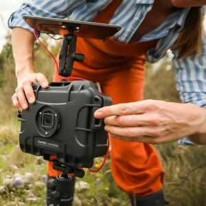
A) Cameras and Camera Software
We use Canon cameras which can be controlled by scripts when running the Canon Hack Development Kit (CHDK). Specifically we currently use the Canon PowerShot A2400 IS. Visit the CHDK site (http://chdk.wikia.com) to find which cameras work with the CHDK software which you install on an SD card without any permanent modifications to your camera. There are a lot of details about running CHDK and installing scripts that you’ll have to get from the CHDK website, but the additional tips below will help you through some of the more difficult parts.
It can get a bit complicated to find the right version of CHDK for your camera, format the card, install the software, etc., so we recommend you use STICK (Simple Tool for Installing CHDK) from http://zenoshrdlu.com/stick/stick.html.
You will also need a script for triggering the camera shutter at set intervals. These kinds of scripts are generally called “intervalometers.” There are many out there, but we’ve had a lot of success with a very simple one. It is written in the Lua language and is based upon an existing intervalometer script (apologies to the original author; I can’t find the original source of this script to give you credit).
Paste the text below into a text document using a text editor (such as Notepad, NOT Word), save it as “interval.lua”, and copy it into the CHDK scripts folder. See the CHDK documentation about how to select and activate this script.
--[[
@title BRIT Intervalometer
@param a = interval (sec)
@default a 5
--]]
repeat
start = get_tick_count()
press("shoot_half")
press("shoot_full")
release("shoot_full")
sleep(a*1000 - (get_tick_count() - start))
until ( false )
B) Camera Rig
BRIT has made two rigs for holding the camera: one for balloon surveys and one for kite surveys.
The balloon rig has a single attachment point and a vane to keep it from spinning and causing blurry photos. Its design is detailed at http://publiclab.org/notes/jbest/11-15-2013/the-brit-camera-rig
The kite rig uses a Picavet suspension which keeps the camera level and has two points of attachment. See some examples and more details at http://www.publiclab.org/wiki/picavet-rigging
Performing the Survey
Rather than duplicate the work done by Public Lab, below are some great resources for how to perform your first aerial survey:
- General aerial mapping information – http://publiclab.org/wiki/balloon-mapping
- Guides – http://publiclab.org/guides#Aerial+mapping
Processing Images
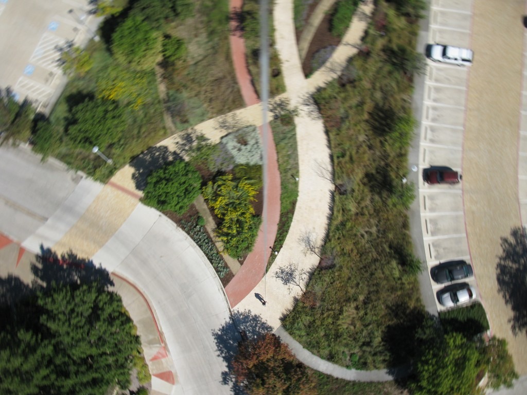
We use VisualSFM (http://ccwu.me/vsfm/) for the initial processing of images. This free software analyzes the images, finds matching points within the images, and constructs a 3D “point cloud” of many points from the terrain and other objects in your survey as well as the location where each image was taken. VisualSFM makes the process a lot easier, but it can still be a bit challenging to get it running and to figure out how to get your first survey processed. See the tutorials below for some tips.
If you want to further process the data to create a single stitched image of the survey area and a 3D model, you can use CMPMVS (http://ptak.felk.cvut.cz/sfmservice/websfm.pl?menu=cmpmvs).
Tutorials
Some of these tutorials are general in nature, some are specifically for balloons or kites, and some are for Unmanned Aerial Vehicles (UAVs, also known as multicopters, drones, or simply radio-controlled aircraft), but they all have some relevance to using various software packages and techniques for kite aerial surveys.
http://flightriot.com/tutorials/post-processing/
http://diydrones.com/video/uav-mapping-using-chdk-visualsfm-and-cmpmvs-skywalker-air-frame
http://diydrones.com/profiles/blogs/make-accurate-realistic-3d-models-with-aerial-photos-from-your